Assess Risk
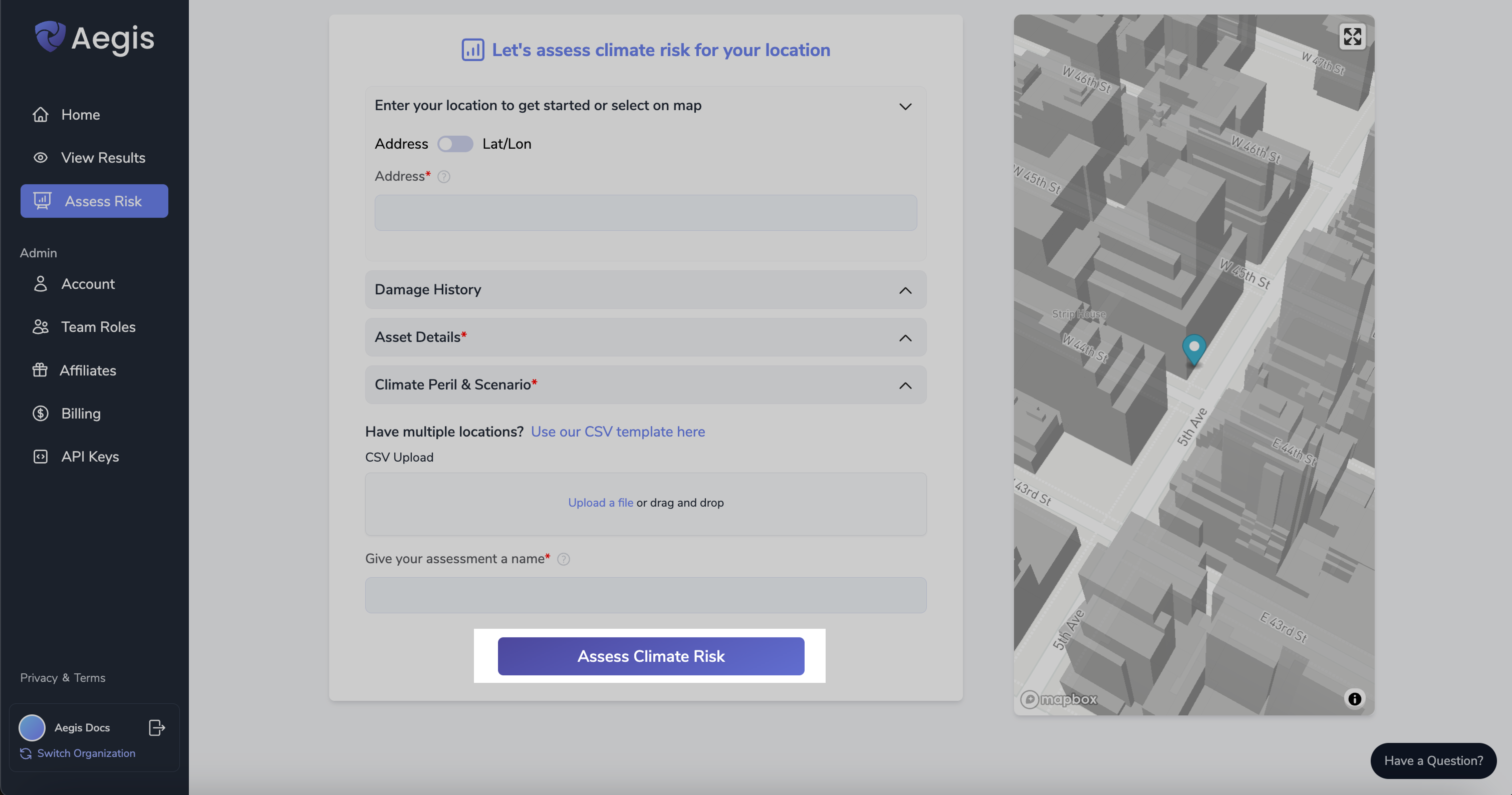
This is the starting point for running assessments in Aegis
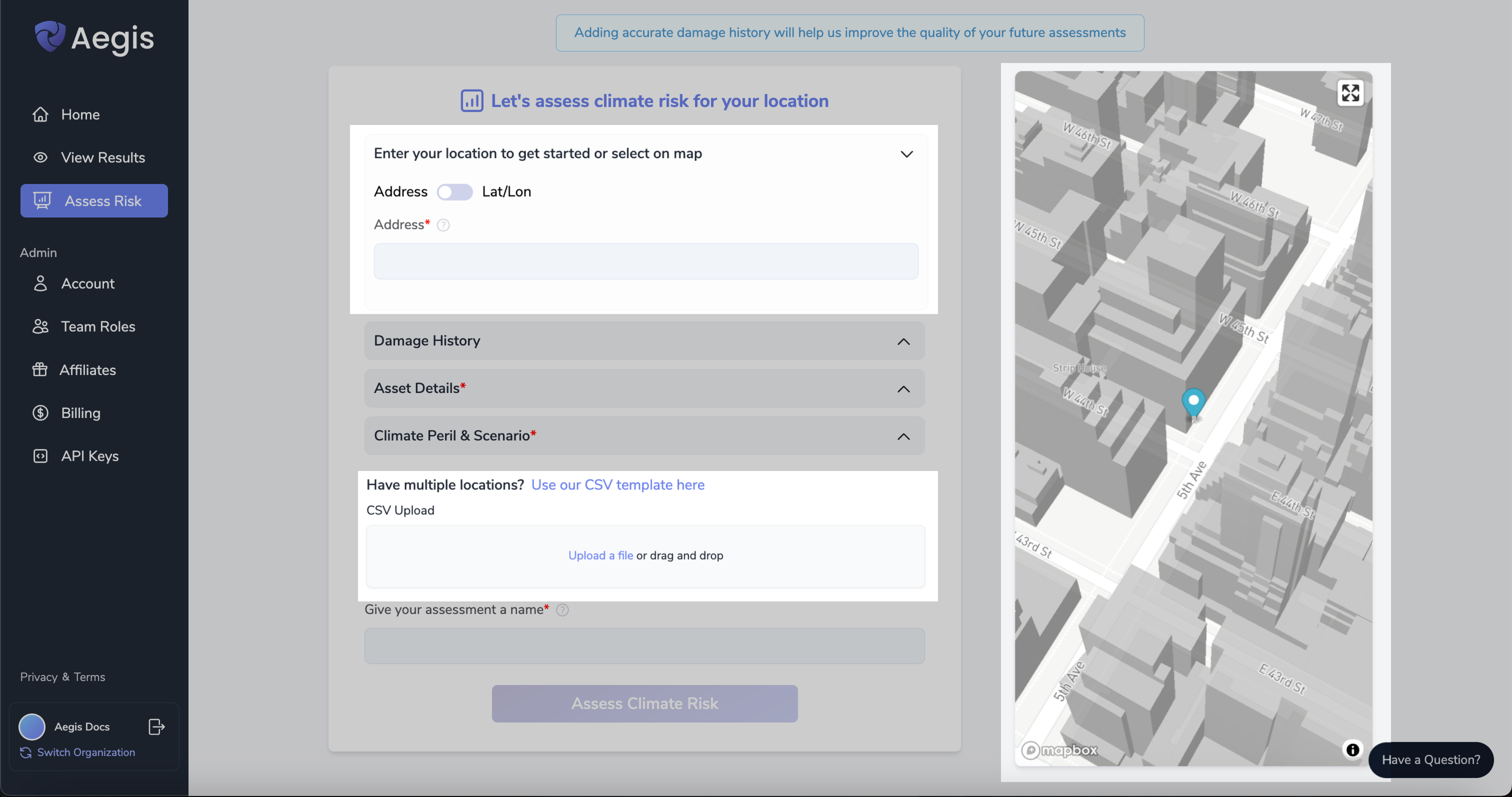
Step 1: Enter Location(s)
- Select a Point on the Map
- Enter a Street Address or a Lat/Lon pair
- or Upload a CSV of Thousands of Locations at Once (template provided)
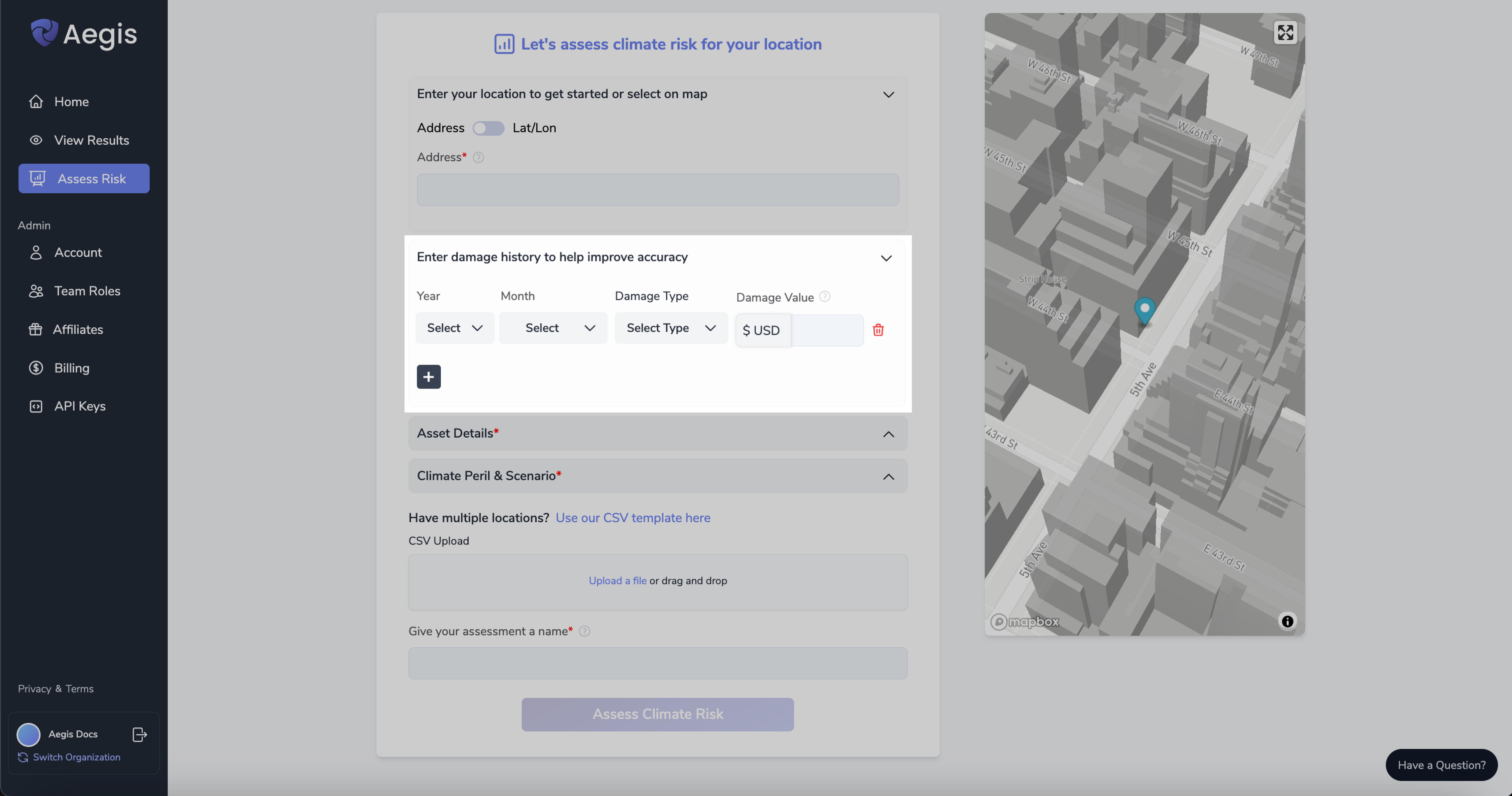
Step 2: Enter Damage History (Optional)
If available, provide a history of any damage previously incurred. This information can enhance the accuracy of the climate risk assessment by offering insights into past vulnerabilities and impacts. Accurate damage history helps us refine our analysis and make more precise predictions for future risk evaluations.
Step 3: Enter Asset Details
In order to generate loss estimates for your asset(s), it is necessary to enter your asset’s value and asset details such as the primary construction material, height, area, building type, etc.
Asset details inform Aegis’s vulnerability model and damage functions, which convert any given peril/hazard magnitude (such as wind speed, hail size, or flood depth) into a damage estimate for building.
The more asset details supplied, the more precise the vulnerability model, yielding tighter confidence intervals on the damage estimates.
If you do not know the construction details of your asset, Aegis will use publicly available information for as many details as possible.
Hazard Only Tiers do not have Damage History or Asset Details as part of the Assess Risk Process
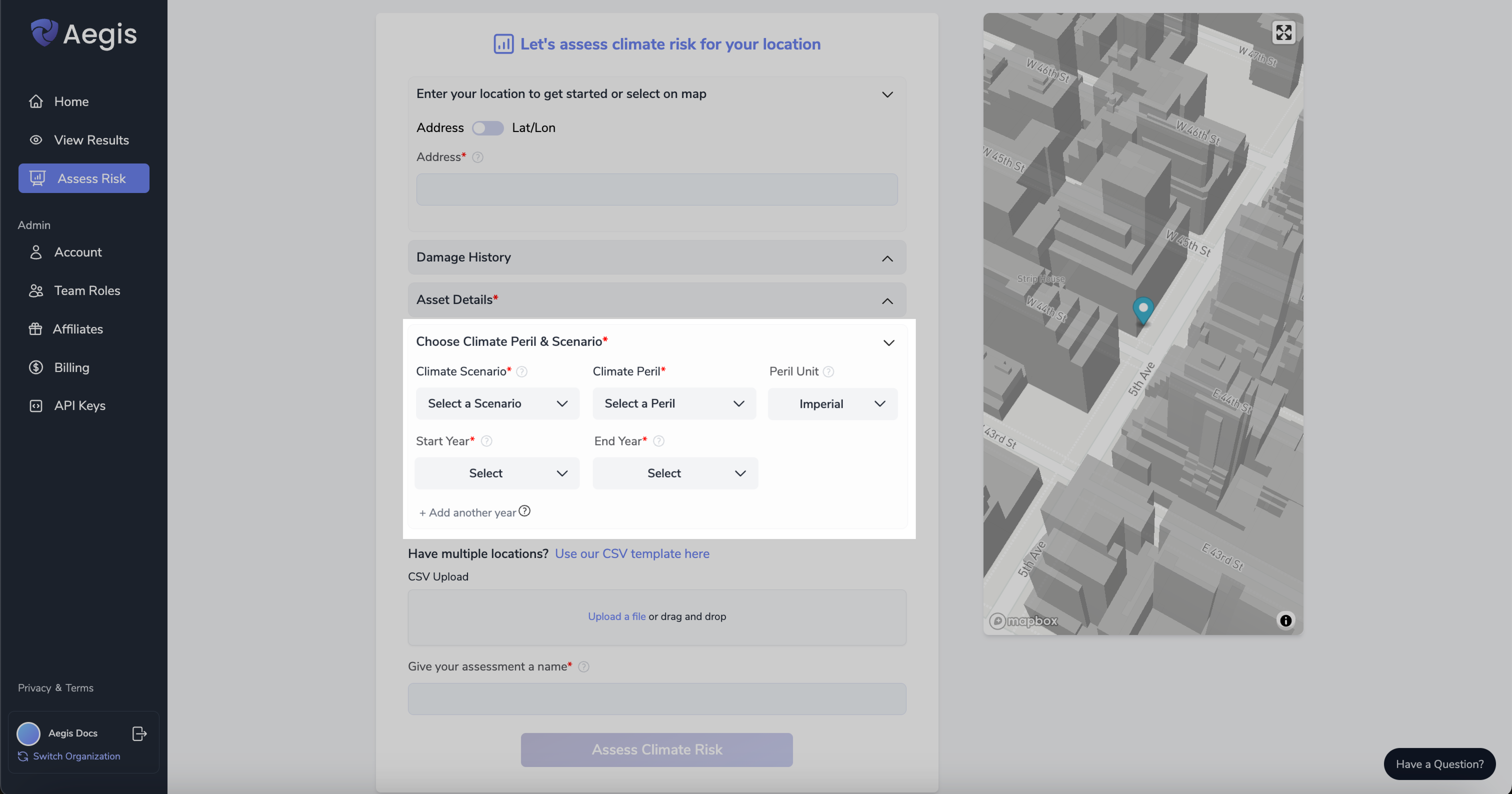
Step 4: Select Climate Perils & Scenarios
-
Select up to 5 Climate Scenarios [Depending on Tier]
- In Aegis, climate scenarios are represented as a combination of the SSP socioeconomic pathways and RCP emissions scenarios developed for the Intergovernmental Panel on Climate Change (IPCC), which range from SSP1-1.9 (in which Paris Climate Accord targets are met) to SSP5-8.5 (in which fossil fuel usage and greenhouse gas emissions continue to accelerate) .
- Within the tool, we represent the five SSP scenarios by their implied levels of global warming by the year 2100.
-
Select up to 14 Climate Perils [Depending on Tier]
- Heat Wave, Cold Outbreak, European Windstorms, Tropical Cyclone, Tsunami, River Flooding, Coastal Flooding, Excessive Rainfall (leading to Flash Flooding), Thunderstorm Wind, Tornado, Hail, Drought, Wildfire, Earthquake.
- We have global coverage at up to 90m resolution for all perils except Severe Convective Storms (SCS Perils), which are currently limited to the US and Australia
- Heat Wave, Cold Outbreak, European Windstorms, Tropical Cyclone, Tsunami, River Flooding, Coastal Flooding, Excessive Rainfall (leading to Flash Flooding), Thunderstorm Wind, Tornado, Hail, Drought, Wildfire, Earthquake.
-
Select up to 5 Time Periods [Depending on Tier]
- Select any period of time from now until 2099
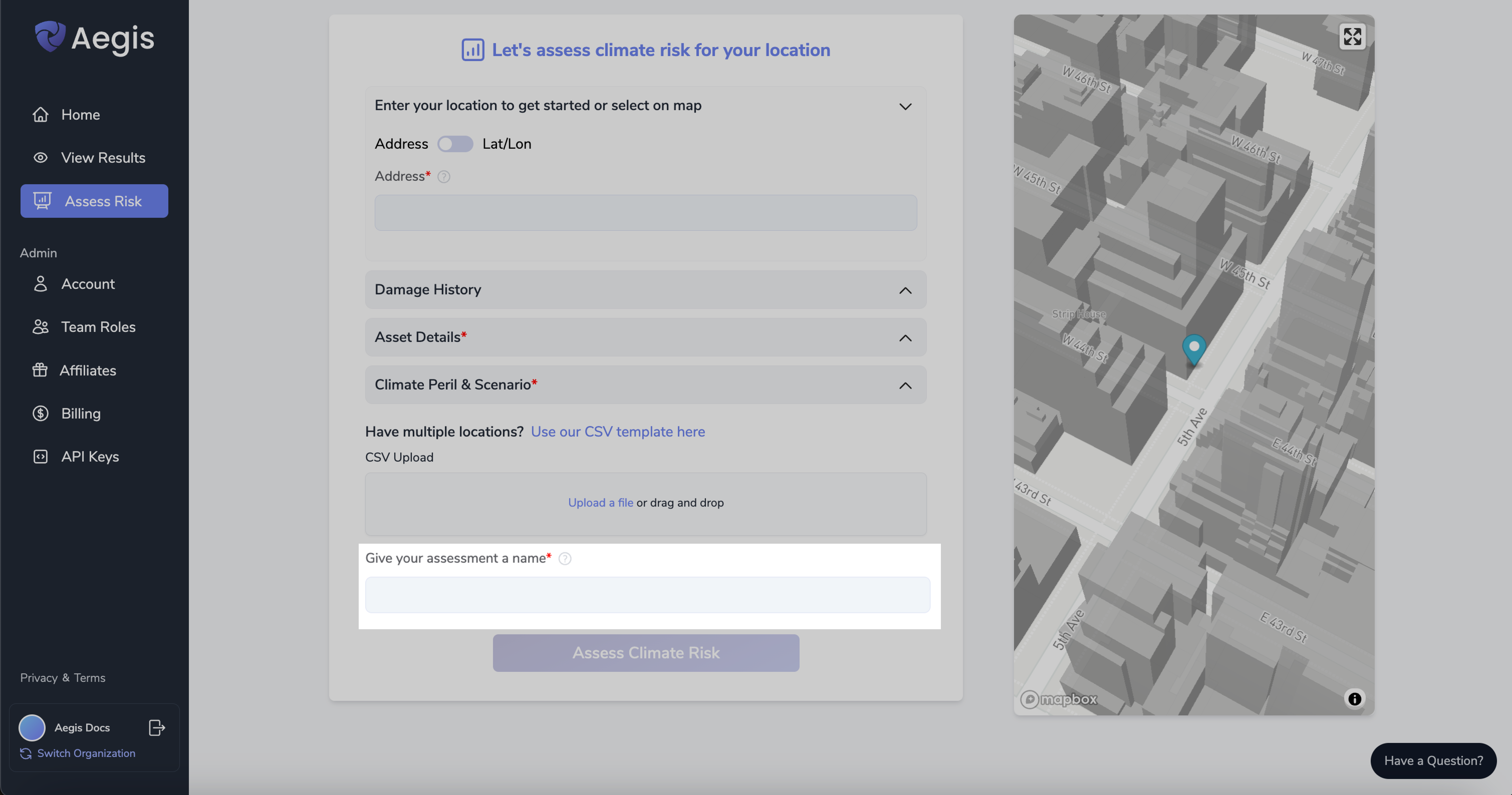
Step 5: Name Your Assessment
Choose a descriptive name for your assessment. This will make it easier to locate and reference in the future.
Step 6: Click “Assess Climate Risk”
Click the 'Assess Climate Risk' button and wait for the analysis to complete. You will be able to view the results of your assessment once it's finished by navigating to either the Home Page or the View Results Page
Need More Help?
If you have further questions regarding running an assessment, please send us an email at support@dclimate.net.
Also, feel free to submit a question using the 'Have a Question?' button located at the bottom right of the screen on Aegis.